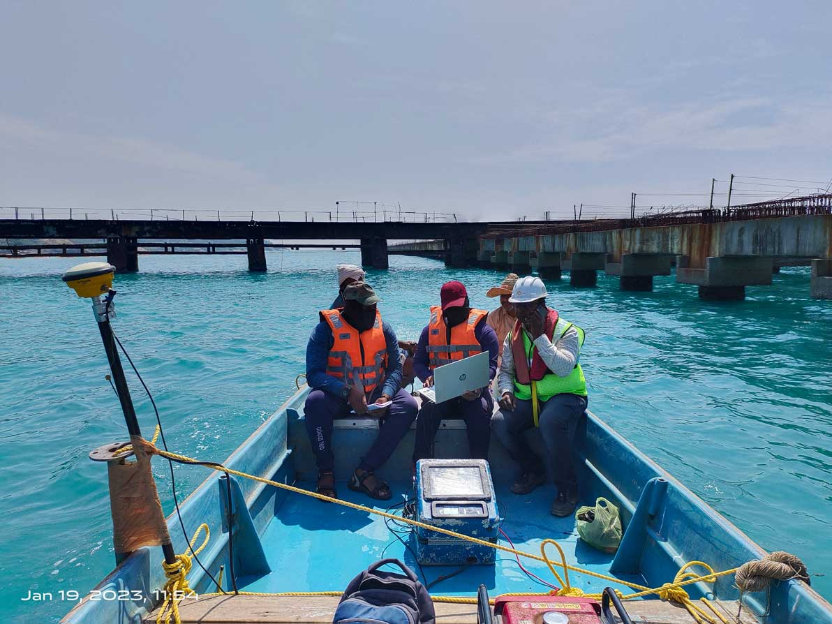
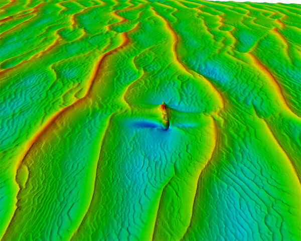
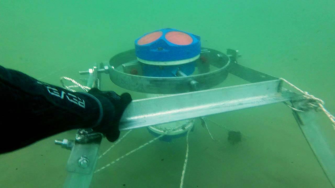
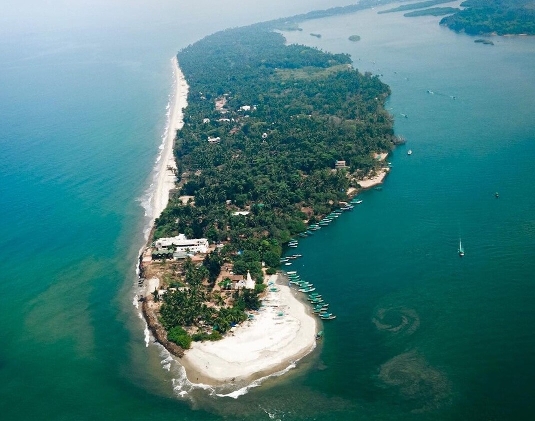
- • Detailed mapping of the seabed and underwater terrain
- • Analysis of the physical and geological characteristics of the seabed
- • Creation of nautical charts and bathymetric maps
- • Surveys for safe navigation, ocean resource management, and coastal zone management
- • Use of state-of-the-art hydrographic and bathymetric survey equipment and technology
- • Capacity survey for reservoirs
x
S
H
A
N
K
A
R
Service Details
Hydrographic and Bathymetric Surveys: Mapping the Submerged World
Geophysical Surveys: Uncovering the Subsurface
- • Comprehensive geophysical survey services to gather subsurface information for various applications including but not limited to: mineral exploration, site investigation, pipeline and cable route, port and harbour development and engineering design
- • Advanced geophysical techniques such as seismic, resistivity, magnetic, and electromagnetic surveys
- • Experienced team of geophysicists equipped with the latest technology and software
- • Integration of multiple geophysical methods to provide a comprehensive view of subsurface features
- • On-time delivery of data and reports that meet industry standards and client requirements
MetOcean Surveys: Understanding the Ocean's Forces
- • Collection of oceanographic and meteorological data to assess conditions in the marine environment
- • Measurement of wave height, direction, period, and wind speed and direction
- • Analysis of currents, tides, and water quality patterns; analysis of tide and current to provide harmonic constituents
- • Provision of crucial data for offshore operations and infrastructure design
- • Integration of data with GIS and mapping technologies for effective visualization and analysis.
- • Mathematical modelling for oil spill, sediment plume using state of the art sofware like Mike 21, Delft3D, Telemac etc
- • Integration of all data to a single platform and providing the data on a realtime basis
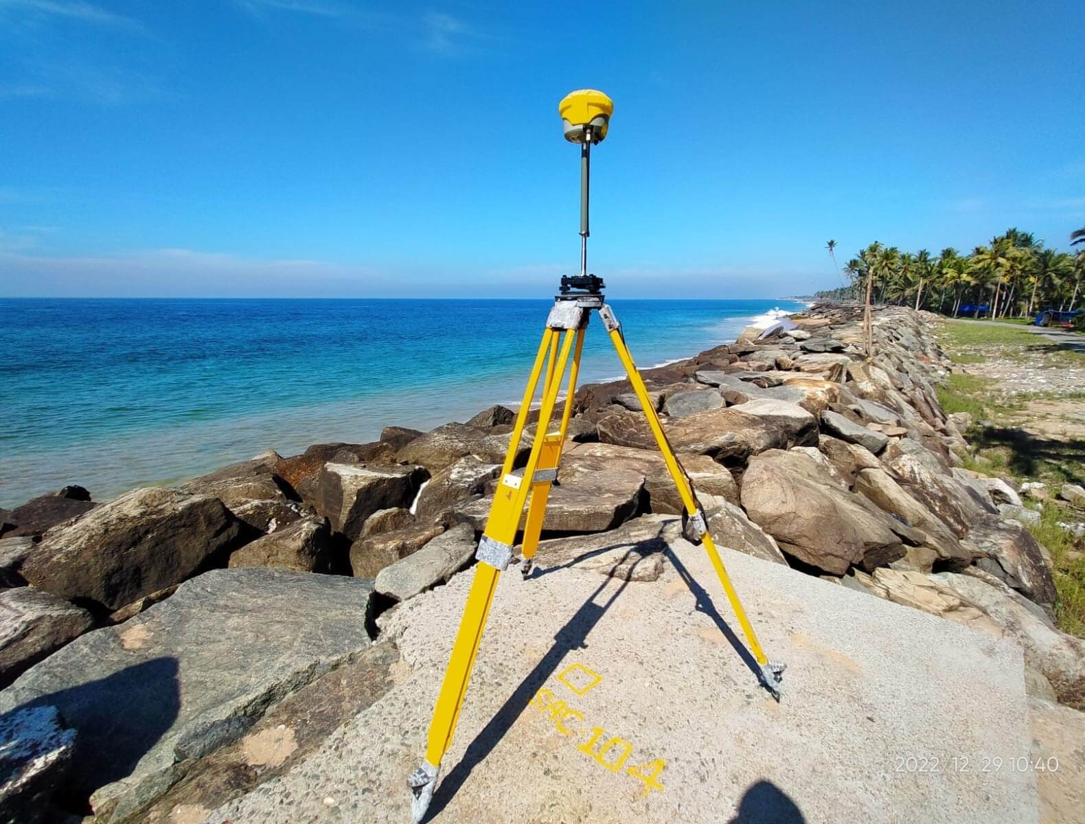
Topographic Surveys: Accurate Mapping of the Terrain
- • Detailed mapping of topographical features on land, including natural and man-made structures
- • Collection and analysis of data such as elevation, slope, aspect, and vegetation
- • Utilization of advanced surveying equipment such as GPS and LiDAR technology
- • Creation of accurate and up-to-date topographical maps for various purposes such as land-use planning, construction, and resource management.
- • Integration with other surveying techniques to provide a comprehensive view of the study area.
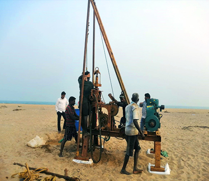
Geotechnical Investigations: Uncovering the Subsurface
- • Comprehensive site investigation for geotechnical engineering projects
- • In-depth analysis of soil and rock properties for foundation design
- • Assessment of site stability and slope stability
- • Ground improvement recommendations and design
- • Foundation design recommendations
- • Laboratory testing and analysis of soil and rock samples
- • Monitoring and instrumentation for construction projects.
River Surveys: Navigating the Flows
- • Comprehensive mapping and assessment of riverbeds and waterways
- • Analysis of hydrological, geomorphological and geotechnical conditions
- • Assessment of river morphology, sediment transport and erosion
- • Determination of water depth and flow velocity for navigation and design purposes
- • Collection and interpretation of data for floodplain mapping and water management plans
- • Integration of survey data with remote sensing and GIS techniques for enhanced results.
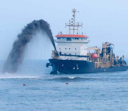
Pre-dredge and Post-dredge Surveys: Charting the Course of Dredging Operations
- • Accurately and efficiently measure and document changes in water depth, sediment and topography before and after dredging activities
- • Ensure compliance with government regulations and industry standards
- • Monitor and report on any potential environmental impact caused by dredging
- • Provide detailed and accurate survey data for project design, planning, and management along with the quantity calculation
- • Develop detailed maps and cross-sections of dredged areas for project documentation and monitoring purposes
- • Conduct regular and thorough inspections of the dredge site to ensure safety and efficiency of dredging activities.
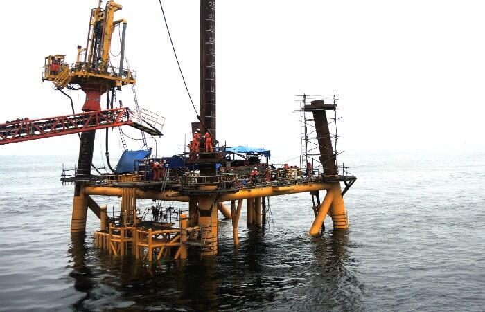
Construction Monitoring Services
- • Comprehensive monitoring and recording of construction site activities
- • Real-time analysis and reporting of construction progress and quality assurance
- • Detection and resolution of potential construction-related issues to ensure timely completion
- • Compliance with regulatory requirements and industry standards
- • Partnership with project managers and contractors to ensure a successful and sustainable construction outcome.

Real-time Monitoring of Environmental Parameters
- • Comprehensive and accurate collection of environmental data with the aid of custom made data buoys
- • Real-time monitoring of key parameters such as temperature, pH, salinity, dissolved oxygen, water level, BOD, turbidity, chlorophyll, blue green algae etc for water quality; wave and current parameters, meteorological data etc
- • Integration with cutting-edge technology for maximum efficiency and accuracy
- • Regular reporting of data and progress to stakeholders
- • Prompt response and mitigation of any potential environmental impacts
- • Compliance with relevant regulations and standards
- • Continuous improvement of monitoring processes to ensure reliable and up-to-date information.